README.md
1<img src="images/README-md/main_logo.png" width="300">
2
3[](https://github.com/qgis/QGIS/actions/workflows/run-tests.yml?query=branch%3Arelease-3_22+event%3Apush)
4[](https://hub.docker.com/r/qgis/qgis/tags)
5[](https://dev.azure.com/qgis/QGIS/_build/latest?definitionId=1&branchName=release-3_22)
6[](https://github.com/qgis/QGIS/actions/workflows/mingw64.yml?query=branch%3Arelease-3_22+event%3Apush)
7
8QGIS is a full-featured, user-friendly, free-and-open-source (FOSS) geographical information system (GIS) that runs on Unix platforms, Windows, and MacOS.
9
10<!-- TOC generated with https://freelance-tech-writer.github.io/table-of-contents-generator/index.html -->
11
12 * [Features](#features)
13 * [1. Flexible and powerful spatial data management](#1-flexible-and-powerful-spatial-data-management)
14 * [2. Beautiful cartography](#2-beautiful-cartography)
15 * [3. Advanced and robust geospatial analysis](#3-advanced-and-robust-geospatial-analysis)
16 * [4. Powerful customization and extensibility](#4-powerful-customization-and-extensibility)
17 * [5. QGIS Server](#5-qgis-server)
18 * [Under the hood](#under-the-hood)
19 * [Versions and release cycle](#versions-and-release-cycle)
20 * [Free and Open Source](#free-and-open-source)
21 * [Installing and using QGIS](#installing-and-using-qgis)
22 * [Documentation](#documentation)
23 * [Help and support channels](#help-and-support-channels)
24 * [Get involved with the community](#get-involved-with-the-community)
25 * [Bug reporting and bug fixing](#bug-reporting-and-bug-fixing)
26 * [New features and enhancements](#new-features-and-enhancements)
27 * [Translations](#translations)
28 * [Other ways to contribute](#other-ways-to-contribute)
29
30## Features
31
32### 1. Flexible and powerful spatial data management
33
34- Supports raster, vector, mesh, and point cloud data in a range of industry-standard formats
35 - *Raster formats include*: GeoPackage, GeoTIFF, GRASS, ArcInfo binary and ASCII grids, ERDAS Imagine SDTS, WMS, WCS, PostgreSQL/PostGIS, and [other GDAL supported formats](https://gdal.org/drivers/raster/index.html).
36 - *Vector formats include*: GeoPackage, ESRI Shapefiles, GRASS, SpatiaLite, PostgreSQL/PostGIS, MSSQL, Oracle, WFS, Vector Tiles and [other OGR supported formats](http://www.gdal.org/ogr_formats.html).
37 - *Mesh formats include*: NetCDF, GRIB, 2DM, and [other MDAL supported formats](https://github.com/lutraconsulting/MDAL#supported-formats).
38 - *Point-cloud format*: LAS/LAZ and EPT datasets.
39- Access and display local files, spatial databases (PostGIS, SpatiaLite, SQL Server, Oracle, SAP HANA), web services (WMS, WCS, WFS, ArcGIS REST services), tile services, etc. <!-- removed DB2 due to https://github.com/qgis/QGIS/pull/41178 -->
40- Visual and numerical digitizing and editing
41- On-the-fly reprojection between coordinate reference systems (CRS)
42- Temporal support
43
44*Example: Temporal animation*
45
46
47
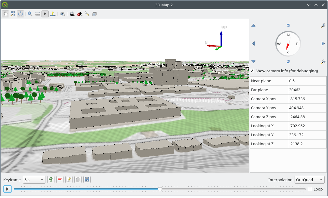
48*Example: 3D map view*
49
50
51
52### 2. Beautiful cartography
53- Large variety of rendering options in 2D and 3D
54- Fine control over symbology, labeling, legends and additional graphical elements for beautifully rendered maps
55- Advanced styling using data-defined overrides, blending modes, and draw effects
56- 500+ built-in color ramps (cpt-city, ColorBrewer, etc.)
57- Create and update maps with specified scale, extent, style, and decorations via saved layouts
58- Generate multiple maps (and reports) automatically using QGIS Atlas and QGIS Reports
59- Flexible output direct to printer, or as image (raster), PDF, or SVG for further customization
60- On-the-fly rendering enhancements using geometry generators (e.g. create and style new geometries from existing features)
61- Preview modes for inclusive map making (e.g. monochrome, color blindness)
62
63*[Example: Map of Bogota, Colombia in the style of Starry Starry Night, by Andrés Felipe Lancheros Sánchez](https://flic.kr/p/2jFfGJP)*
64
65
66
67For more maps created with QGIS, visit the [QGIS Map Showcase Flickr Group](https://www.flickr.com/groups/2244553@N22/pool/with/50355460063/).
68
69
70
71### 3. Advanced and robust geospatial analysis
72- Powerful processing framework with 200+ native processing algorithms
73- Access to 1000+ processing algorithms via providers such as GDAL, SAGA, GRASS, OrfeoToolbox, as well as custom models and processing scripts
74- Geospatial database engine (filters, joins, relations, forms, etc.), as close to datasource- and format-independent as possible
75- Immediate visualization of geospatial query and geoprocessing results
76- Graphical modeler and batch processing
77
78*Example: Travel isochrones*
79
80
81
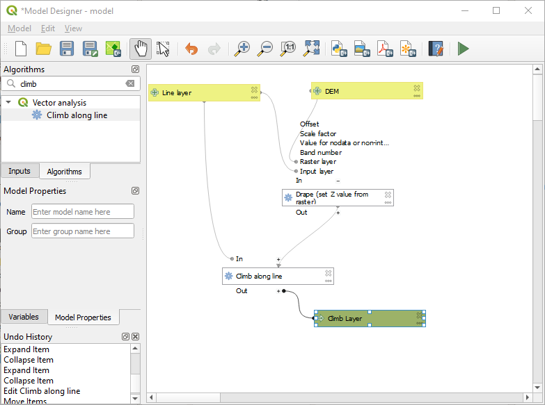
82*Example: Graphical model*
83
84
85
86### 4. Powerful customization and extensibility
87
88- Fully customizable user experience, including user interface and application settings that cater to power-users and beginners alike
89- Rich [expression engine](https://docs.qgis.org/testing/en/docs/user_manual/working_with_vector/expression.html) for maximum flexibility in visualization and processing
90- Broad and varied [plugin ecosystem](https://plugins.qgis.org/) that includes data connectors, digitizing aids, advanced analysis and charting tools, in-the-field data capture, etc.
91- Style manager for creating, storing, and managing styles
92- [QGIS style hub](https://plugins.qgis.org/styles/) for easy sharing of styles
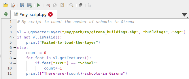
93- Python and C++ API for standalone (headless) applications as well as in-application comprehensive scripting (PyQGIS)
94
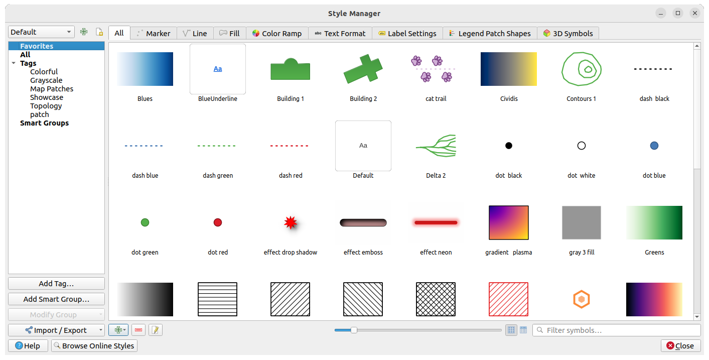
95*Example: Style manager*
96
97
98
99*Example: Plugins*
100
101
102
103<!-- Kill this one for now, since it's Python2 not 3
104Example: Python console
105
106
107-->
108
109### 5. QGIS Server
110
111Headless map server -- running on Linux, macOS, Windows, or in a docker container -- that shares the same code base as QGIS.
112
113- Industry-standard protocols (WMS, WFS, WFS3/OGC API for Features and WCS) allow plug-n-play with any software stack
114- Works with any web server (Apache, nginx, etc) or standalone
115- All beautiful QGIS cartography is supported with best-in-class support for printing
116- Fully customizable with Python scripting support
117
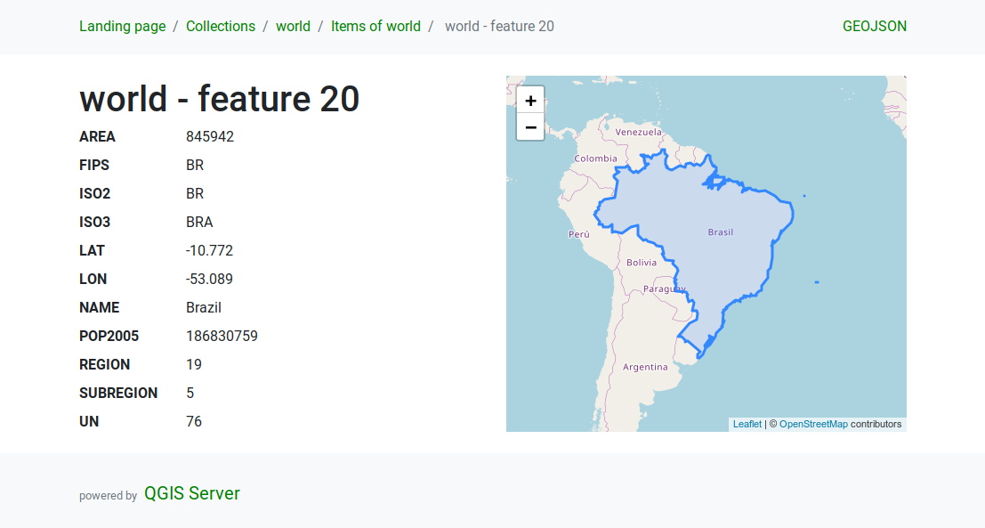
118*Example: QGIS server WMS response*
119
120
121
122*Example: QGIS server WFS response*
123
124
125
126## Under the hood
127
128QGIS is developed using the [Qt toolkit](https://qt.io) and C++, since 2002, and has a pleasing, easy to use graphical
129user interface with multilingual support. It is maintained by an active developer team and supported by vibrant
130community of GIS professionals and enthusiasts as well as geospatial data publishers and end-users.
131
132### Versions and release cycle
133
134QGIS development and releases follow a [time based schedule/roadmap](https://www.qgis.org/en/site/getinvolved/development/roadmap.html). There are three main branches of QGIS that users can install. These are the **Long Term Release (LTR)** branch, **Latest Release (LR)** branch, and the **Development (Nightly)** branch.
135
136Every month, there is a **Point Release** that provides bug-fixes to the LTR and LR.
137
138### Free and Open Source
139
140QGIS is released under the GNU Public License (GPL) Version 2 or any later version.
141Developing QGIS under this license means that you can (if you want to) inspect
142and modify the source code and guarantees that you, our happy user will always
143have access to a GIS program that is free of cost and can be freely
144modified.
145
146QGIS is part of the Open-Source Geospatial Foundation ([OSGeo](https://www.osgeo.org/)), offering a range of complementary open-source GIS software projects.
147
148## Installing and using QGIS
149
150Precompiled binaries for QGIS are available at [the QGIS.org download page](https://www.qgis.org/en/site/forusers/download.html).
151Please follow the installation instructions carefully.
152
153The [building guide](INSTALL.md) can be used to get started with building QGIS from source.
154
155For installation of QGIS Server, see its [getting started documentation](https://docs.qgis.org/testing/en/docs/server_manual/getting_started.html).
156
157### Documentation
158
159A range of [documentation](https://qgis.org/en/docs/index.html) is available. This includes:
160
161- [Training Manual](https://docs.qgis.org/latest/en/docs/training_manual/index.html)
162- [QGIS User Guide](https://docs.qgis.org/latest/en/docs/user_manual/index.html)
163- [QGIS Server Guide](https://docs.qgis.org/latest/en/docs/server_manual/index.html)
164- [Visual Changelog](https://qgis.org/en/site/forusers/visualchangelogs.html)
165- [Documentation Guidelines](https://docs.qgis.org/latest/en/docs/documentation_guidelines/index.html)
166- [QGIS Python (PyQGIS) Cookbook](https://docs.qgis.org/latest/en/docs/pyqgis_developer_cookbook/index.html)
167- [QGIS Python (PyQGIS) API](https://qgis.org/pyqgis/)
168- [QGIS C++ API](https://qgis.org/api/)
169- [Developers Guide](https://docs.qgis.org/latest/en/docs/developers_guide/index.html)
170
171### Help and support channels
172
173There are several channels where you can find help and support for QGIS:
174
175- Using the [QGIS community site](https://qgis.org)
176- Joining the [qgis-users mailing list](https://lists.osgeo.org/mailman/listinfo/qgis-user)
177- Chatting with other users real-time. *Please wait around for a response to your question as many folks on the channel are doing other things and it may take a while for them to notice your question. The following paths all take you to the same chat room:*
178 - Using an IRC client and joining the [#qgis](http://webchat.freenode.net/?channels=#qgis) channel on irc.freenode.net.
179 - Using a Matrix client and joining the [#qgis:matrix.org](http://matrix.to/#/#qgis:matrix.org) room.
180 - Using [Gitter](https://gitter.im/qgis/QGIS) chat.
181 - At the [GIS stackexchange](https://gis.stackexchange.com/) or [r/QGIS reddit](https://www.reddit.com/r/QGIS/), which are not maintained by the QGIS team, but where the QGIS and broader GIS community provides lots of advice
182- [Other support channels](https://qgis.org/en/site/forusers/support.html)
183
184## Get involved with the community
185
186### Bug reporting and bug fixing
187
188You can help us **by submitting bug reports or fixing bugs** in the [QGIS bug tracker](https://github.com/qgis/QGIS/issues/).
189
190### New features and enhancements
191
192If you wish to contribute patches you can:
193
1941. [fork the project](https://help.github.com/forking/)
1951. make your changes
1961. commit to your repository
1971. and then [create a pull request](https://help.github.com/articles/creating-a-pull-request-from-a-fork/).
198
199 The development team can then review your contribution and commit it upstream as appropriate.
200
201If you commit a new feature, add `[FEATURE]` to your commit message AND give a clear description of the new feature. The label `Needs documentation` will be added by maintainers and will automatically create an issue on the QGIS-Documentation repo, where you or others should write documentation about it.
202
203For large-scale changes, you can open a [QEP (QGIS Enhancement Proposal)](https://github.com/qgis/QGIS-Enhancement-Proposals). QEPs are used in the process of creating and discussing new enhancements or policy for QGIS.
204
205### Translations
206
207Please help translate QGIS to your language. At this moment about forty languages are already available in the Desktop user interface and about eighty languages are available in transifex ready to be translated.
208
209The [translation](https://qgis.org/en/site/getinvolved/translate.html) process is managed by the [Translation Team](https://qgis.org/en/site/getinvolved/governance/governance.html#gui-translation) and all the activities are done under the [Transifex](https://www.transifex.com/qgis/) platform.
210
211### Other ways to contribute
212
213If you are not a developer, there are many other possibilities which do not require programming skills to help QGIS to evolve. Check our [project homepage for more information](https://qgis.org/en/site/getinvolved/index.html).
214
)
)
)